Research
Much of our method comes from research projects funded by the European Space Agency (ESA) and Poland’s National Centre for Research and Development (NCBR). We turn research results into solutions for clients, and we process satellite, aerial and drone imagery on our own platform.
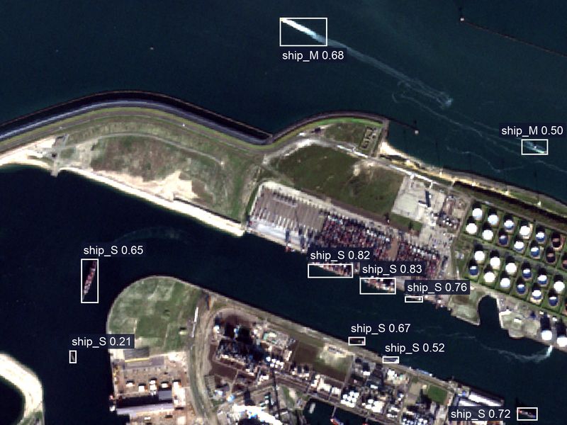
Ships our model found in the port of Rotterdam. Sentinel-2, 17 November 2018. Cropped. The number by each box is the model’s confidence.
Projects
-
EO4Soil
FunderEuropean Space Agency (ESA)
Our roleConsortium lead
What it coversSoil condition from satellite data
StatusRunning, October 2026 – July 2027
Earth Observation for Soil degradation detection and reduction. 5 October 2026 – 5 July 2027.
-
AgriSatCom
FunderNational Centre for Research and Development (NCBR)
Our roleConsortium lead
What it coversAI on satellite, aerial and drone images for agriculture and archaeology: crop condition, yield forecasts, crop classification, object detection, burnt areas, crop disease
StatusRunning, October 2024 – September 2027
The system for recognizing and analyzing satellite, aircraft and UAV photos for agriculture and archaeology. Agreement INFOSTRATEG6/0023/2023/A, signed 12 September 2024. 1 October 2024 – 30 September 2027. Project page
- EOImageNET FunderEuropean Space Agency (ESA) Our roleSole contractor What it coversObject detection in satellite, aerial and drone imagery worldwide, 26 object types StatusCompleted, October 2024 – January 2026
EO4Soil is carried out under a programme of, and co-funded by, the European Space Agency. The views expressed here can in no way be taken to reflect the official opinion of the European Space Agency.
AgriSatCom. Project co-funded by the National Centre for Research and Development under the INFOSTRATEG Strategic Programme.
EOImageNET has received EISI support from ESA. This page reflects only our view and not that of the Agency, and the Agency is not responsible for any use that may be made of the information it contains.
Case study: EOImageNET
The task
One set of methods to find objects in satellite, aerial and drone images anywhere in the world and at different resolutions, from wind turbines and bridges to ships and solar panels.
What we built
Five detection models covering 26 object types, working across resolutions and conditions, built so they can be retrained for a specific business case.
The business test
Analysing and estimating ship traffic in ports. We confirmed the high accuracy of our analysis in tests covering the ports of Rotterdam, Shanghai and Edinburgh.